
Bethany’s List of Trails to 500 Miles!

Little Wild Horse Canyon
In January 2015, Bethany—three years old at the time—began hiking without any assistance from Mom or Dad. A little over three years later, on April 1, 2018 at Lands End, San Francisco, CA, she crossed her 500th mile on the trails!
Our hikes have been enjoyable experiences, where we have learned a little about a broad range of topics, ranging from basic finance to plate tectonics, and she has become a great hiking partner. To commemorate her milestone, I have compiled a list of every hiking trail we have visited, with links offering additional information to our own personal notes. Hoping for many more miles to come!
This list is divided into hikes within and outside California, and the location provided is where we started our hikes.
Within California:
Location: San Francisco Bay (we boarded the ferry at Tiburon)
Effort Level: Moderate
Restrooms at/near trailhead: Yes
Trail Type/Surface: Paved loop
Fee: Yes
Our trail notes: The path is a paved five-mile loop, and the island is accessible by ferry. Awesome views of the San Francisco Bay! Be prepared for the shifting temperatures around different sections of the loop.

Angel Island State Park
Armstrong Redwoods State Natural Reserve
Location: Guerneville, CA
Effort Level: Various
Restrooms at/near trailhead: Yes
Trail Type/Surface: Various
Fee: No (if parking at visitor center)
Our trail notes: Several different trails to choose from at this redwood forest, and a great place to hike if you are looking for shade from the hot summer sun.
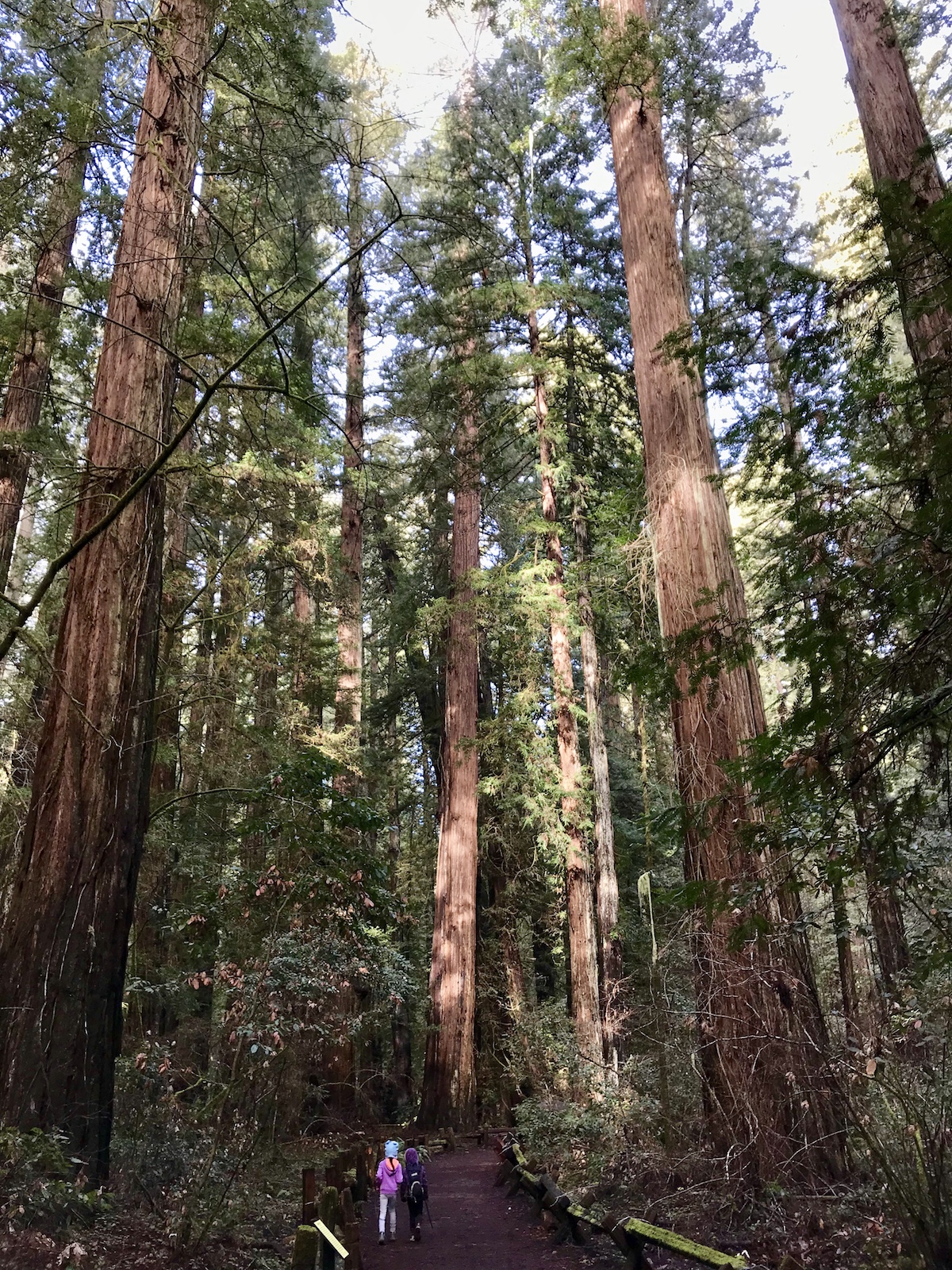
Armstrong Redwoods State Natural Reserve
Location: Bodega Bay, CA
Effort Level: Easy
Restrooms at/near trailhead: Yes
Trail Type/Surface: Dirt loop
Fee: No
Our trail notes: An approximately 2-mile hike with great views of the ocean from the cliffs!

Bodega Head
Location: Fairfax, CA
Effort Level: Easy
Restrooms at/near trailhead: Yes
Trail Type/Surface: Dirt loop
Fee: Yes
Our trail notes: The loop around the lake is 4.1 miles, half of which is shaded by evergreens and oak. The trail is flat except for a few short sections of stairs and brief ascents. Lake Lagunitas is right next door, and both hikes combined is approximately six miles.

Bon Tempe Lake
Location: Burney, CA
Effort Level: Moderate
Restrooms at/near trailhead: Yes
Trail Type/Surface: Dirt/paved loop
Fee: Yes
Our trail notes: The 129-foot waterfall flows year round, and is an amazing sight! We hiked the 1.2 mile loop which takes you to the base of the waterfall, then an ascent back up to near the top of the waterfall.

Burney Falls
Calaveras Big Trees State Park
Location: Arnold, CA
Effort Level: Easy
Restrooms at/near trailhead: Yes
Trail Type/Surface: Dirt/paved/boardwalk loop
Fee: Yes
Our trail notes: We hiked a 1.6 mile loop starting at the North Grove Visitor Center, and were amazed by the size of the giant sequoias!
Calaveras Big Trees State Park
Carquinez Regional Shoreline (Bull Valley Staging Area)
Location: Crockett, CA
Effort Level: Easy
Restrooms at/near trailhead: Yes
Trail Type/Surface: Dirt out-and-back
Fee: No
Our trail notes: Our 2-mile hike included a brief stop at Eckley Pier, with a great view of the Alfred Zampa Memorial Bridge spanning the Carquinez Strait.
Carquinez Regional Shoreline
Location: Fairfax, CA
Effort Level: Moderate
Restrooms at/near trailhead: No
Trail Type/Surface: Dirt out-and-back
Fee: No
Our trail notes: The destination is a nice waterfall, best seen after rain. Round trip total is 3.4 miles.

Carson Falls
Castle Rock Regional Recreation Area
Location: Walnut Creek, CA
Effort Level: Easy
Restrooms at/near trailhead: Yes
Trail Type/Surface: Dirt out-and-back
Fee: No
Our trail notes: Located in the Diablo foothills, we were searching for marine fossils during our 3-mile round trip hike. We did not find any, but we still enjoyed views of the rocky canyon adjacent to the trail.

Castle Rock Regional Recreation Area
Location: San Rafael, CA
Effort Level: Easy
Restrooms at/near trailhead: Yes
Trail Type/Surface: Dirt out-and-back
Fee: Yes
Our trail notes: The particular trail we hiked (I cannot remember the name!) was six miles round trip through mostly forest, which led to a great view of San Pablo Bay.
China Camp State Park
Location: San Francisco, CA
Effort Level: Easy
Restrooms at/near trailhead: Yes
Trail Type/Surface: Paved out-and-back
Fee: No
Our trail notes: This hike is one of Bethany’s favorites! Opportunities to play in the beach, explore an old military fort, fly kites, and have a picnic with a great view of the San Francisco Bay. Total round trip is 3.3 miles from the parking area to the fort.

Crissy Field to Fort Point
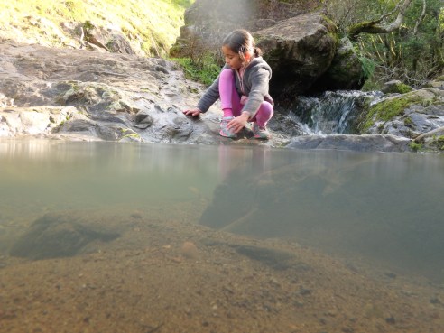
Dawn Falls Trail (Baltimore Canyon)
Location: near Larkspur, CA
Effort Level: Easy (short steep ascent to reach waterfall)
Restrooms at/near trailhead: No
Trail Type/Surface: Dirt out-and-back
Fee: No
Our trail notes: The trailhead for our 2.25-mile hike is located on a quiet residential street; be aware of any parking restrictions! This hike is great after storms, when Larkspur Creek is flowing, and 30-ft-high Dawn Falls is roaring. When the creek and falls are dry, the shade from the summer heat is a relief.

Dawn Falls
Location: near Lone Pine, CA
Effort Level: Easy
Restrooms at/near trailhead: No
Trail Type/Surface: Dirt/salt out-and-back
Fee: Yes
Our trail notes: Death Valley feels like another planet! We hiked at three locations here: Badwater Basin is a salt flat and is the lowest point in North America at 282 feet below sea level; Natural Bridge is a 0.6 mile round trip hike featuring an arch; and Mosaic Canyon is a slot canyon featuring marble and breccia walls.
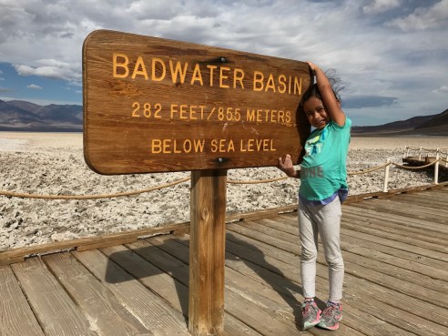
Death Valley National Park
Location: Bodega Bay, CA
Effort Level: Easy
Restrooms at/near trailhead: Yes
Trail Type/Surface: Beach out-and-back
Fee: Yes
Our trail notes: Doran Beach can be a great place to visit when the wind is calm!

Doran Regional Park
Fairway Falls (Ignacio Valley Open Space Preserve)
Location: Novato, CA
Effort Level: Easy
Restrooms at/near trailhead: No
Trail Type/Surface: Dirt out-and-back
Fee: No
Our trail notes: Trailhead is located at the end of a residential cul-de-sac on Fairway Drive, and the feature of this 1.25-mile round trip hike is the seasonal waterfall.

Fairway Falls
Location: San Francisco/Sausalito, CA
Effort Level: Easy
Restrooms at/near trailhead: Yes
Trail Type/Surface: Paved out-and-back
Fee: No (Yes, for parking)
Our trail notes: Depending on where you park your vehicle, this walk can range from 4 to 5 miles round trip. On weekdays, be aware of speeding cyclists! We have parked on both the west and east side of the bridge in San Francisco, with plenty of spaces available in the morning.
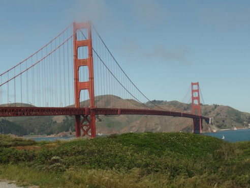
Golden Gate Bridge
Location: Suisun City, CA
Effort Level: Easy
Restrooms at/near trailhead: No
Trail Type/Surface: Dirt out-and-back
Fee: Yes
Our trail notes: Various parking areas are available; we chose Parking Lot 3, crossed a little bridge, and explored from there. In the distance, we saw a large herd of tule elk seemingly gawking at us.
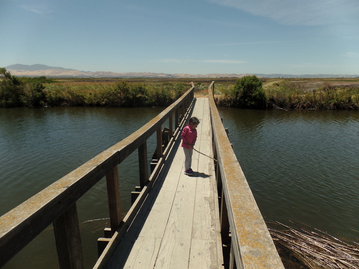
Grizzy Island Wildlife Area
Location: Occidental, CA
Effort Level: Easy
Restrooms at/near trailhead: No
Trail Type/Surface: Dirt loop
Fee: No
Our trail notes: A quiet grove of redwoods, where you can bring a picnic blanket and enjoy a quick snack or lunch. We completed the one-mile loop, and were amazed at some of the larger trees.

Grove of the Old Trees
Location: Petaluma, CA
Effort Level: Easy/Moderate
Restrooms at/near trailhead: Yes
Trail Type/Surface: Dirt/Paved
Fee: Yes
Our trail notes: Bethany completed her first unassisted hike here; we hiked to the pond and spent some time tossing stones into the water. At the parking area, benches and a playground are available.

Helen Putnam Regional Park
Location: Novato, CA
Effort Level: Moderate
Restrooms at/near trailhead: Yes
Trail Type/Surface: Dirt lollipop
Fee: Yes
Our trail notes: Along the Waterfall Trail during the wetter months, you’ll see a small waterfall and an area where children can explore the mini pools leading to it.
Indian Valley
Location: Lagunitas, CA
Effort Level: Easy
Restrooms at/near trailhead: Yes (no restrooms at the pools)
Trail Type/Surface: Dirt/paved out-and-back
Fee: Yes (at Samuel Taylor State Park)
Our trail notes: We incorporated this spot into our hike from Samuel Taylor State Park via the Cross Marin Trail, 4.75-miles round-trip. The natural pools are awesome, and Bethany enjoyed dipping her toes into them.

The Inkwells, Lagunitas, CA
Jack London State Historic Park
Location: Glen Ellen, CA
Effort Level: Easy/Moderate
Restrooms at/near trailhead: Yes
Trail Type/Surface: Dirt loop
Fee: Yes
Our trail notes: We chose the path that lead us past the graves of Jack and Charmian London, and the ruins of the Wolf House which was destroyed by a fire in August 1913.
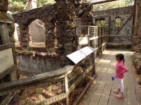
Jack London State Historic Park
Location: near Yucca Valley/San Bernardino, CA
Effort Level: Easy
Restrooms at/near trailhead: Yes
Trail Type/Surface: Dirt loop/out-and-back
Fee: Yes
Our trail notes: In addition to admiring the views of Joshua trees and the desert landscape, we hiked three sights at this park—Arch Rock Nature Trail, Cholla Cactus Garden, and Hidden Valley—and all were spectacular!
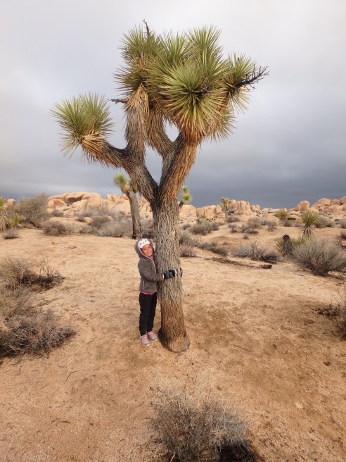
Joshua Tree National Park
Location: Napa County, on lake’s western shoreline
Effort Level: Easy
Restrooms at/near trailhead: Yes
Trail Type/Surface: Dirt out-and-back
Fee: No
Our trail notes: A mostly level hike which takes you close to the lake’s shore.
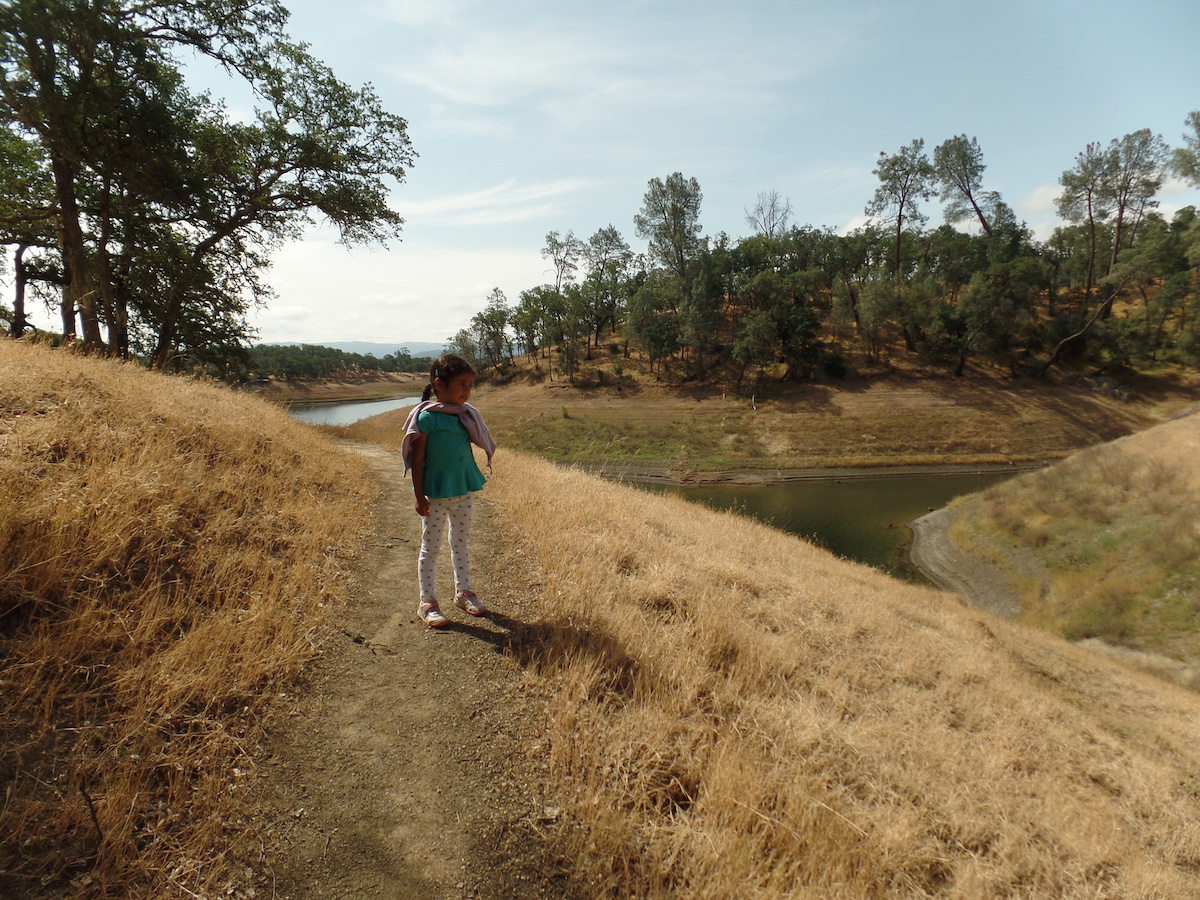
Lake Berryessa: Smittle Creek
Location: near St Helena, CA
Effort Level: Easy
Restrooms at/near trailhead: No
Trail Type/Surface: Dirt out-and-back
Fee: No
Our trail notes: A pleasant hike along the shore, with a great view of the lake.

Lake Hennessey
Location: near Fairfax, CA
Effort Level: Easy
Restrooms at/near trailhead: Yes
Trail Type/Surface: Dirt loop
Fee: Yes
Our trail notes: One of our favorite trails! The 1.8-mile loop is mostly shaded by oak and evergreens, and the picnic area is a great place for a snack/lunch. Keep an eye out for newts during wet months! Combine this with the loop around Bon Tempe Lake for a six-mile hike.
Lake Lagunitas
Location: San Francisco, CA
Effort Level: Easy (with short stairs descent/ascent)
Restrooms at/near trailhead: No
Trail Type/Surface: Dirt/paved out-and-back
Fee: No
Our trail notes: Bethany enjoyed her walk through the labyrinth, with a great view of the bay, Marin Headlands, and the Golden Gate Bridge along the way. We parked near Sutro Baths and explored the cave and ruins on our return, a total of 2.25 miles round-trip.
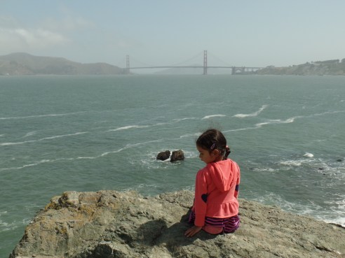
Lands End
Location: San Francisco, CA
Effort Level: Easy/Moderate
Restrooms at/near trailhead: Yes
Trail Type/Surface: Paved loop
Fee: For parking at Chinatown
Our trail notes: We parked in Chinatown (near Pacific and Grant, northwest corner, and after touring Chinatown headed for Lombard Street via Columbus Ave, to ascend this world-famous crooked road. Total of 2.5 miles round-trip.
Matt Davis–Steep Ravine–Dipsea Loop
Location: 37º53’47.8″N 122º38’09.5″W, Stinson Beach, CA
Effort Level: Moderate/Difficult
Restrooms at/near trailhead: No (restrooms located along trail)
Trail Type/Surface: Dirt loop
Fee: No
Our trail notes: We parked at Stinson Beach near the corner of Shoreline and Panoramic, and hiked this approximately 7-mile trail in a clockwise direction. The first two miles of the hike will have your heart pounding, with the rest of the loop a mostly gradual descent. Be ready to descend a 10-foot ladder on the Steep Ravine section of the hike.
Steep Ravine Trail
Location: near Calistoga, CA
Effort Level: Easy/Moderate
Restrooms at/near trailhead: No
Trail Type/Surface: Dirt out-and-back
Fee: No
Our trail notes: A hike, shaded by towering Douglas Firs and oak, takes you past a monument dedicated to the site where Robert Louis Stevenson and his bride honeymooned in the summer of 1880.
Location: San Francisco, CA
Effort Level: Easy/Moderate
Restrooms at/near trailhead: No
Trail Type/Surface: Dirt out-and-back
Fee: No
Our trail notes: A eucalyptus forest in the middle of dense urban environment! We parked at the corner of 17th and Stanyan and opted for the summit via the “Fairy Gates”, a total of 1.8 miles.
Mount Sutro
Mount Tamalpais: WWII Aircraft Crash Site
Location: Mill Valley, CA
Effort Level: Easy/Moderate
Restrooms at/near trailhead: No
Trail Type/Surface: Dirt out-and-back
Fee: No
Our trail notes: Our 3-mile round trip hike along the Gravity Car Road-Railroad Grade-Vic Haun Trails featured aircraft wreckage from WWII, (coordinates N 37° 55.376′ W 122° 34.436′, just in case your app is not helping). The wreckage is located off the Vic Haun Trail, on an unmarked trail. Along the way, the views of San Francisco are amazing.

Mount Tamalpais: WWII Aircraft Crash Site
Mount Tamalpais: Mill Valley Air Force Station
Location: Mill Valley, CA
Effort Level: Easy/Moderate
Restrooms at/near trailhead: Yes
Trail Type/Surface: Dirt out-and-back
Fee: No
Our trail notes: We parked near the Mountain Theater (off E Ridgecrest Blvd at Rock Spring Trail) and hiked the gradual ascent northwest via the Mountain Top Trail. All that remains are foundations of Cold War-era buildings, yet we had a great time exploring the area.
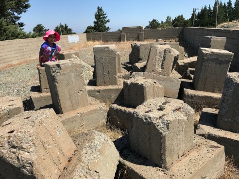
Mount Tamalpais: Mill Valley Air Force Station
Mount Tamalpais: “Mysterious” Car Wreck
Location: Mill Valley, CA
Effort Level: Easy
Restrooms at/near trailhead: Yes
Trail Type/Surface: Dirt out-and-back
Fee: Yes (at Pantoll Campground)
Our trail notes: A mysterious car wreck (near 37º54’38″N 122º37’35″W) on the slopes of Mount Tamalpais was our destination for this hike, located on the Bolinas Ridge trail, approximately a quarter mile from where it splits off from the Matt Davis Trail. We parked at the Pantoll Campground, crossed Panoramic Highway, and headed west on the Matt Davis Trail, a 4.5-mile round trip.
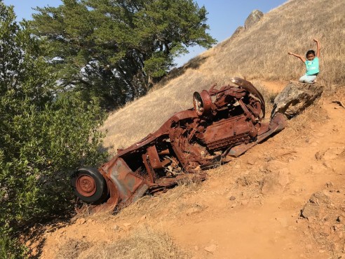
Mount Tamalpais: “Mysterious” Car Wreck
Mount Tamalpais: Cataract Falls via Cataract Trail (from Rock Springs Trailhead)
Location: Mill Valley, CA
Effort Level: Easy/Moderate
Restrooms at/near trailhead: Yes
Trail Type/Surface: Dirt out-and-back
Fee: No
Our trail notes: Another favorite, especially when the creek and waterfalls are flowing. Starting from Rock Springs Trailhead, a hike along the Cataract Trail to the first waterfall is 3.6 miles round-trip. A round-trip hike to Alpine Lake is approximately 5.6 miles.

Mount Tamalpais: Cataract Falls Trail
Location: Mill Valley, CA
Effort Level: Easy/Moderate
Restrooms at/near trailhead: Yes
Trail Type/Surface: Dirt out-and-back
Fee: Yes
Our trail notes: It’s a rocky half-mile round trip from the parking area to the top of Mount Tam’s east peak, but on a clear day, it is well worth the view!
Mount Tamalpais: Steep Ravine Trail
Location: Mill Valley, CA
Effort Level: Easy/Moderate
Restrooms at/near trailhead: Yes
Trail Type/Surface: Dirt out-and-back
Fee: Yes (at Pantoll Campgrounds)
Our trail notes: On days when we wanted shade from the summer sun, we would come to this trail for a nice out-and-back, which includes a seasonal creek, redwoods, and a 10-foot ladder Bethany enjoys ascending and descending.

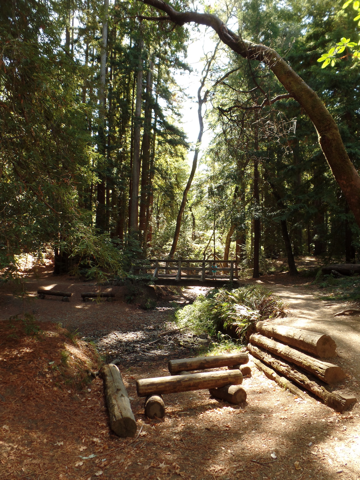
Steep Ravine Trail, Mount Tamalpais, Marin County
Location: Mill Valley, CA
Effort Level: Easy
Restrooms at/near trailhead: Yes
Trail Type/Surface: Dirt/paved/boardwalk out-and-back
Fee: Yes
Our trail notes: Several trail options are available for exploration, but our favorite path takes us along Redwood Creek straight through the park until we reach the Mount Tamalpais State Park boundary; from there, we continue on along the Bootjack Trail until we reach a turnaround point (usually near a bridge overlooking an awesome display of the creek rushing over some boulders).
Location: near Santa Rosa, CA
Effort Level: Easy/Moderate
Restrooms at/near trailhead: Yes
Trail Type/Surface: Dirt out-and-back
Fee: Yes
Our trail notes: We took the Umbrella Tree Trail and enjoyed views of Santa Rosa and Bennett Valley, for a 1.75 mile round trip hike.
Location: Novato, CA
Effort Level: Easy
Restrooms at/near trailhead: No
Trail Type/Surface: Dirt out-and-back
Fee: No
Our trail notes: We parked at the end of Pacheco Creek Drive and hiked a short distance to see the seasonal waterfall, a total of .75 miles round trip. On another occasion, I let Bethany play in the creek while I sat and enjoyed the surroundings.
Location: near Ross, CA
Effort Level: Easy
Restrooms at/near trailhead: Yes
Trail Type/Surface: Dirt loop
Fee: No
Our trail notes: A 2.8 mile shaded loop around a lake, just as enjoyable as Lake Lagunitas! Come early; parking is limited and a short queue sometimes forms; our longest wait was only 15 minutes.
Pinnacles National Park: Balconies Cave Trail
Location: near Soledad, CA
Effort Level: Easy/Moderate
Restrooms at/near trailhead: Yes
Trail Type/Surface: Dirt out-and-back
Fee: Yes
Our trail notes: Bring your flashlights when you explore the talus caves! We parked near the Chaparral Trailhead and hiked 2.2 miles round trip past spectacular rock formations, over/under boulders, and through dark caves. Check their website for cave closures.

Pinnacles National Park: Balconies Cave Trail
Point Reyes National Seashore: Abbotts Lagoon
Location: West Marin County, CA
Effort Level: Easy
Restrooms at/near trailhead: Yes
Trail Type/Surface: Dirt out-and-back
Fee: No
Our trail notes: An approximately 3-mile hike round trip past two lagoons to the ocean, where you can have a picnic and wade in the water.
Point Reyes National Seashore: Abbotts Lagoon
Point Reyes National Seashore: Bear Valley
Location: West Marin County, CA
Effort Level: Easy
Restrooms at/near trailhead: Yes
Trail Type/Surface: Dirt out-and-back
Fee: No
Our trail notes: A shaded hike adjacent to a creek, on a trail shared with horseback riders. A four-mile hike one-way will take you out to the ocean.
Point Reyes National Seashore: Earthquake Trail
Location: West Marin County, CA
Effort Level: Easy
Restrooms at/near trailhead: Yes
Trail Type/Surface: Dirt loop
Fee: No
Our trail notes: Learn about the 1906 San Francisco Earthquake and the San Andreas Fault on this trail; straddle the area between the replica wooden fence that was displaced 20 feet from each other because of that earthquake. Located across the street from the Bear Valley Visitor Center.
Point Reyes National Seashore: Lighthouse
Location: West Marin County, CA
Effort Level: Moderate/Difficult
Restrooms at/near trailhead: Yes
Trail Type/Surface: Paved/stairs
Fee: No
Our trail notes: Be prepared to descend, then ascend, 308 steps! The round-trip distance is approximately 1.2 miles; check the website for hours of operation if you are interested in touring the lighthouse’s interior.

Point Reyes National Seashore: Lighthouse
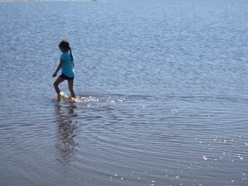
Point Reyes National Seashore: Limantour Beach
Location: West Marin County, CA
Effort Level: Easy
Restrooms at/near trailhead: Yes
Trail Type/Surface: Beach out-and-back
Fee: No
Our trail notes: We hiked approximately four miles round trip along the shore with the intent to reach Sculptured Beach, but because Bethany had more fun playing in the water, we had to cut our trip short.
Location: San Francisco, CA
Effort Level: Moderate
Restrooms at/near trailhead: Yes
Trail Type/Surface: Beach out-and-back
Fee: No
Our trail notes: Our destination was the Lovers’ Lane Trail (37º47’53″N 122º27’18″W) to check out Wood Line. We also explored the historic military installation, and during certain times of the year a food truck “picnic” is held on Sundays.

Presidio
Location: Oakland, CA
Effort Level: Moderate
Restrooms at/near trailhead: Yes
Trail Type/Surface: Dirt loop
Fee: No
Our trail notes: A third-growth redwood forest, with 150-foot trees towering over us. We completed a 3.75 mile loop through the forest, starting at the Skyline Gate Staging Area.
Location: Corte Madera, CA
Effort Level: Easy/Moderate
Restrooms at/near trailhead: No
Trail Type/Surface: Dirt out-and-back
Fee: No
Our trail notes: We shrieked with joy when we spotted our first Tiburon Mariposa Lily, a flower that grows nowhere else in the world except for this location, due to the serpentine-rich soil. At the top of the hill, several huge metamorphic boulders are available for a snack break, with awesome views of the bay. Approximately two miles round trip.

Ring Mountain
Location: Fairfield, CA
Effort Level: Easy/Moderate
Restrooms at/near trailhead: No
Trail Type/Surface: Dirt
Fee: Yes
Our trail notes: Different trail combinations are available here; we completed a 3-mile out-and-back from the main parking area.
Rosie the Riveter WWII Home Front
Location: Richmond, CA
Effort Level: Easy
Restrooms at/near trailhead: Yes
Trail Type/Surface: Paved out-and-back
Fee: No
Our trail notes: We completed a two-mile out-and-back along the waterfront, to the impressive memorial. The museum dedicated to the hard-working women of WWII is awesome; also, you may get the chance to meet 96-year-old Betty Reid Soskin, National Park Service’s oldest ranger.

Rosie the Riveter WWII Home Front
Location: Woodacre, CA
Effort Level: Easy
Restrooms at/near trailhead: No
Trail Type/Surface: Dirt loop
Fee: No
Our trail notes: A cozy redwoods preserve (38º01’13″N 122º39’42″W) taking you past some towering redwoods; we completed a 2.5-mile loop.
Location: Los Angeles, CA
Effort Level: Easy/Moderate
Restrooms at/near trailhead: No
Trail Type/Surface: Dirt out-and-back
Fee: No
Our trail notes: The only hike on which I did not accompany my daughter! She was with her family in Los Angeles when she hiked this trail.
Location: near Jenner, CA
Effort Level: Easy
Restrooms at/near trailhead: No
Trail Type/Surface: Dirt out-and-back
Fee: No
Our trail notes: From the trail head along Hwy 1, we walked along the cliffs to Gerstle Cove for a 3-mile round trip hike. The “tafoni”, rock formations, and tide pools are great for exploring!

Salt Point Trail
Location: Sausalito, CA
Effort Level: Easy
Restrooms at/near trailhead: No
Trail Type/Surface: Paved out-and-back
Fee: No
Our trail notes: We accessed the houseboat docks traveling southeast via the Mill Valley-Sausalito multi-use path (in Mill Valley, off Miller Avenue), and upon reaching the docks explored some interesting houseboat neighborhoods! We completed a 3.5 mile round trip walk, and were especially quiet around the houseboats out of respect for the residents.
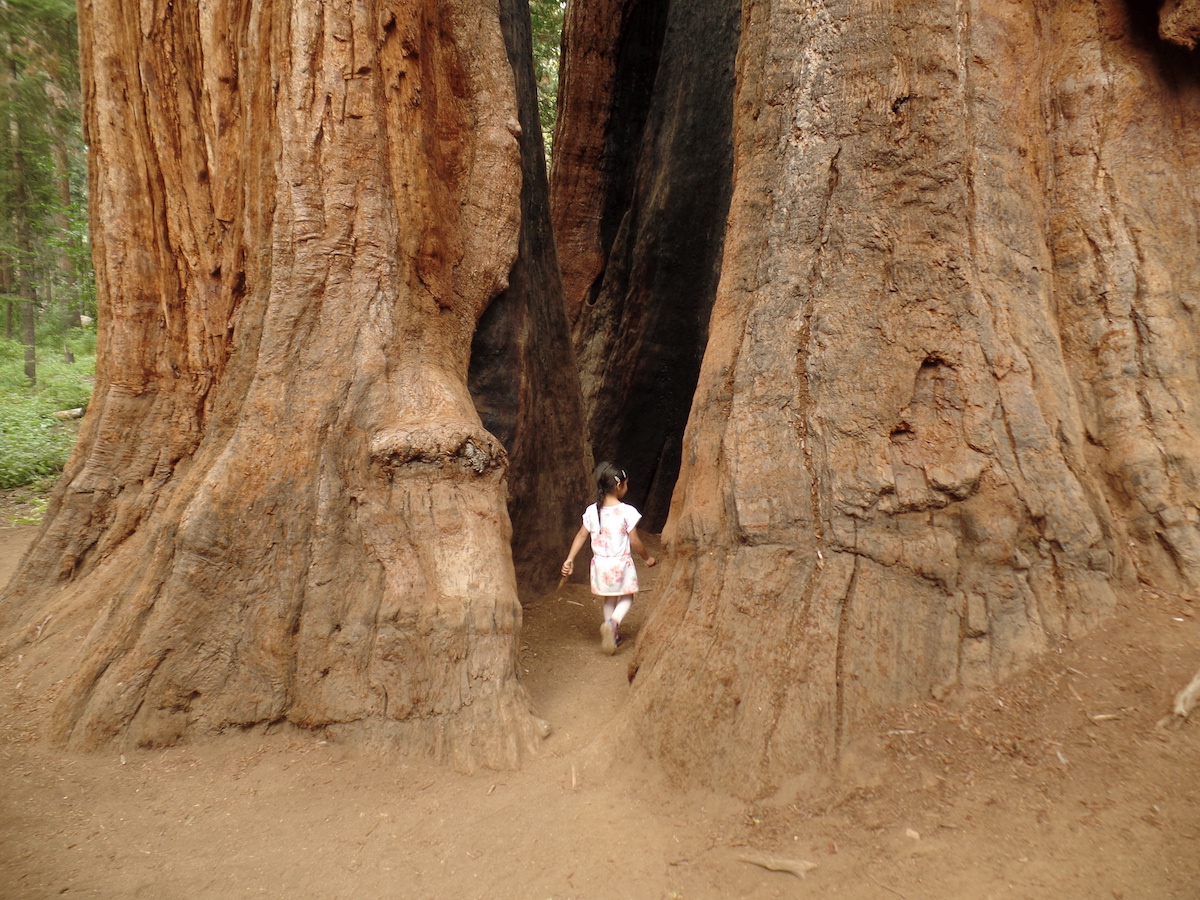
Sequoia & Kings Canyon National Parks: General Sherman Tree
Location: near Three Rivers, CA
Effort Level: Easy
Restrooms at/near trailhead: Yes
Trail Type/Surface: Paved out-and-back
Fee: Yes
Our trail notes: Our main destination at this park was the General Sherman Tree, a half-mile round trip from our parking area. This tree is massive—”the world’s largest tree measured by volume”—an amazing sight to behold! This was our single destination in this park during our return trip home from Death Valley.

The General Sherman Tree
Location: Petaluma, CA
Effort Level: Easy
Restrooms at/near trailhead: Yes
Trail Type/Surface: Dirt loop
Fee: No
Our trail notes: Located close to home for us, and an easy 2.1 mile loop suitable for joggers, walkers, kids, dogs, and jogging strollers.
Sibley Volcanic Regional Preserve
Location: Oakland, CA
Effort Level: Easy/Moderate
Restrooms at/near trailhead: Yes
Trail Type/Surface: Dirt out-and-back
Fee: No
Our trail notes: The opportunity to explore a 10-million-year-old dormant volcano, right here in the Bay Area! We completed an out-and-back with the turnaround at the labyrinth inside Round Top Volcano.
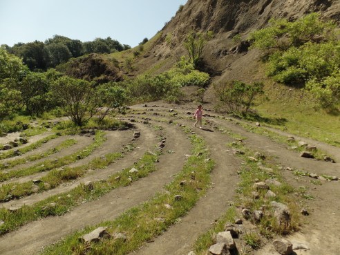
Sibley Volcanic Regional Preserve, Oakland, CA
Location: South San Francisco, CA
Effort Level: Easy/Moderate
Restrooms at/near trailhead: No
Trail Type/Surface: Dirt loop
Fee: No
Our trail notes: On the letter “Y” of the hillside sign that reads, “SOUTH SAN FRANCISCO THE INDUSTRIAL CITY”, we had our snack break and enjoyed views of the cityscape and SFO. The giant letters are up to 60 feet long!
Sign Hill, South San Francisco, CA
Location: Napa, CA
Effort Level: Easy/Moderate
Restrooms at/near trailhead: Yes
Trail Type/Surface: Dirt out-and-back
Fee: Yes
Our trail notes: We hiked a 2-mile out-and-back in this park located in the foothills of Napa Valley.
Location: Sonoma, CA
Effort Level: Easy/Moderate
Restrooms at/near trailhead: Yes
Trail Type/Surface: Dirt out-and-back
Fee: No
Our trail notes: As you ascend the hill via some gentle switchbacks, you’ll be treated to a nice view of the city of Sonoma. Our total round-trip hike was a little over two miles.
Sugarloaf Ridge State Park: Planet Walk
Location: Kenwood, CA
Effort Level: Easy/Moderate
Restrooms at/near trailhead: Yes
Trail Type/Surface: Dirt out-and-back
Fee: Yes
Our trail notes: Pluto is on average 3.7 billion miles away from Earth; however, on this hike, the dwarf planet is easily accessible. Every step is approximately a million miles, and the speed of light is a step every five seconds. Start at the Sun, and you’ll quickly walk past Mercury, Venus, and Earth. Then, as you travel on, you’ll appreciate the scale model of the distance between the planets. Our round trip hike to Pluto and back was 5.6 miles.
Location: near San Bruno/Pacifica, CA
Effort Level: Moderate
Restrooms at/near trailhead: No
Trail Type/Surface: Dirt/paved out-and-back
Fee: No
Our trail notes: We hiked 3.6 miles round trip to the memorial marking the point where the first Europeans viewed San Francisco Bay, back in 1769.
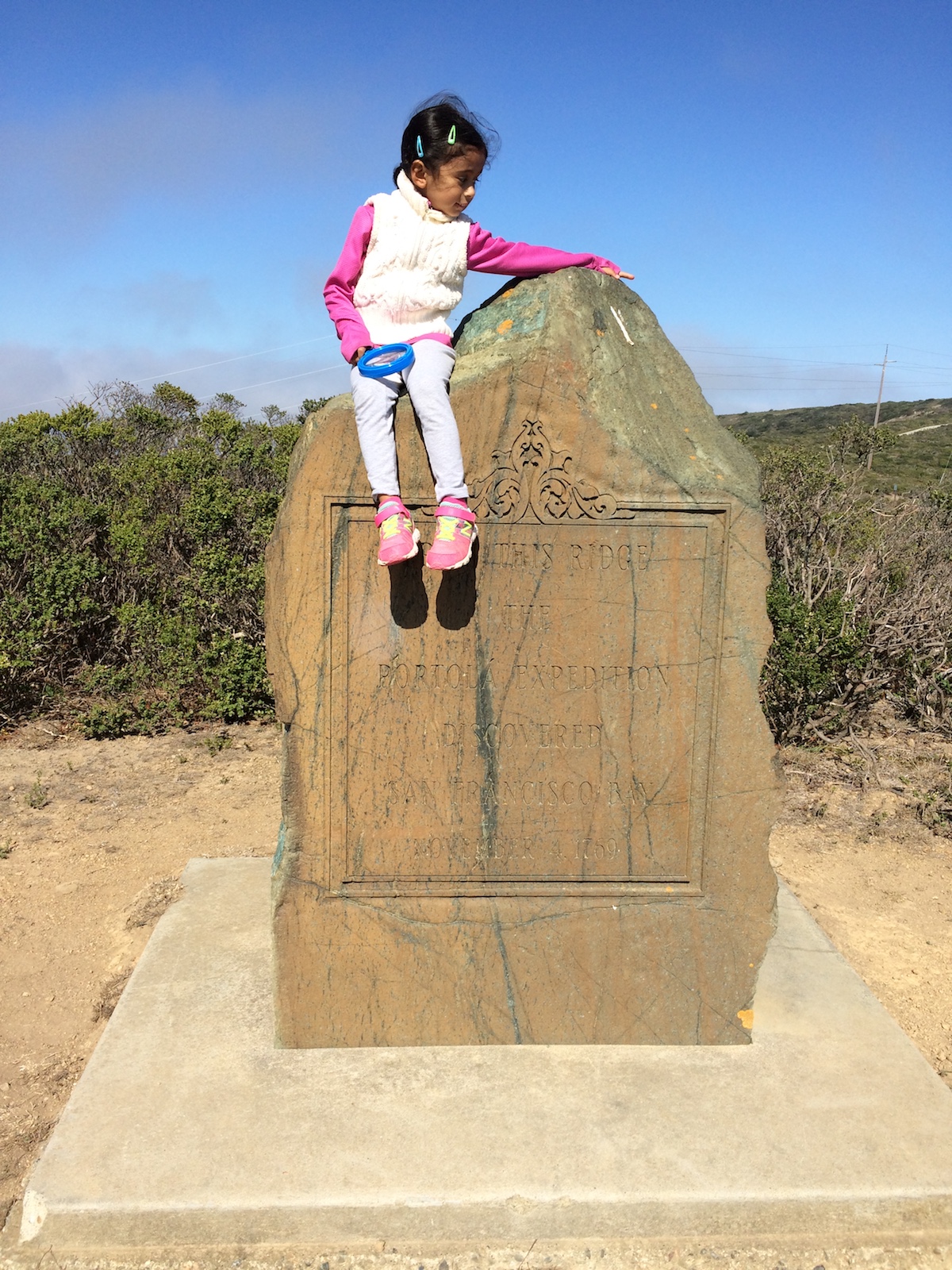
Sweeney Ridge
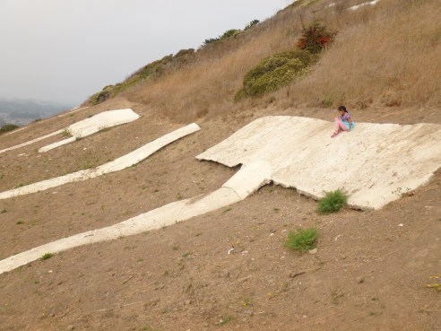
Location: near Calistoga, CA
Effort Level: Moderate
Restrooms at/near trailhead: No
Trail Type/Surface: Dirt/rocky out-and-back
Fee: No
Our trail notes: The trailhead is located across the street from Mount Saint Helena’s. It’s a roller coaster of hike (4.2 miles round trip) with some rocky trails, but the view from Table Rock is worth it! Table Rock itself is a huge rock outcropping that is relatively flat as compared with its surroundings, and somewhat resembles a lunar landscape. Along the way, admire the two labyrinths mysteriously constructed here (and please let me know if you have any info on how they got there).

Table Rock Trail, Calistoga, CA
Taylor Mountain (from Kawana Terrace)
Location: Santa Rosa, CA
Effort Level: Moderate/Difficult
Restrooms at/near trailhead: Yes
Trail Type/Surface: Dirt out-and-back
Fee: Yes
Our trail notes: Be prepared to get your heart pumping as you ascend close to the summit! Round trip is approximately 3.2 miles, the first half of which is almost all climbing.
Location: Mill Valley, CA
Effort Level: Easy
Restrooms at/near trailhead: Yes
Trail Type/Surface: Dirt/paved out-and-back
Fee: No
Our trail notes: The turnaround point is Tennessee Cove, a great place for a snack break for the ocean view. Trip length is 3.6 miles round trip.
Tomales Bay State Park: Heart’s Desire
Location: Inverness, CA
Effort Level: Easy/Moderate
Restrooms at/near trailhead: Yes
Trail Type/Surface: Dirt loop
Fee: Yes
Our trail notes: We enjoyed a 3.25 mile loop starting at Heart’s Desire that took us past Jepson Memorial Grove, dedicated to a virgin grove of Bishop pine. At the beach, the water is calm, perfect for children interested in splashing around.
Location: San Francisco, CA
Effort Level: Easy
Restrooms at/near trailhead: No
Trail Type/Surface: Dirt/paved out-and-back
Fee: No
Our trail notes: During our hike, we were drenched by a downpour, but we still enjoyed the view of San Francisco from the island’s perspective. Starting from the Administration Building, we walked to the Avenue of the Palms, continued on to the Perimeter Road, and hiked around the island as far as we could before construction sites (we were last here May 2016) forced us to turn back.
Location: Davis, CA
Effort Level: Easy
Restrooms at/near trailhead: Yes
Trail Type/Surface: Paved loop
Fee: No (campus parking is free on weekends)
Our trail notes: An awesome 3.5 mile loop around Putah Creek showcasing thousands of plant species. From our parking spot, we headed north across the street and walked the loop in a clockwise direction which, to me, saved the best sections of the arboretum for last.
Outside California:
Location: Moab, Utah
Effort Level: Various
Restrooms at/near trailhead: Yes
Trail Type/Surface: slick rock/dirt/paved
Fee: Yes
Our trail notes: Bethany hiked four different trails here: Delicate Arch is a moderate 3.1 mile out-and-back to Utah’s iconic arch; Double Arch is an easy 0.6 mile out-and-back; Park Avenue is an easy 2-mile out-and-back; and Sand Dune Arch is an easy half-mile out-and-back.

Arches National Park
Bryce Canyon National Park: Tower Bridge
Location: Utah
Effort Level: Moderate
Restrooms at/near trailhead: Yes
Trail Type/Surface: Dirt out-and-back
Fee: Yes
Our trail notes: This is a 3.4 mile round trip hike taking you past amazing hoodoos and other sandstone formations to a rock structure that resembles the bridge in London.

Bryce Canyon National Park
Canyonlands National Park: Murphy Point
Location: near Moab, Utah
Effort Level: Easy
Restrooms at/near trailhead: No
Trail Type/Surface: Dirt out-and-back
Fee: Yes
Our trail notes: The 3.6 mile round trip hike includes an amazing view of the valley carved by the Green River, and the trail is flat except for a few small hills.
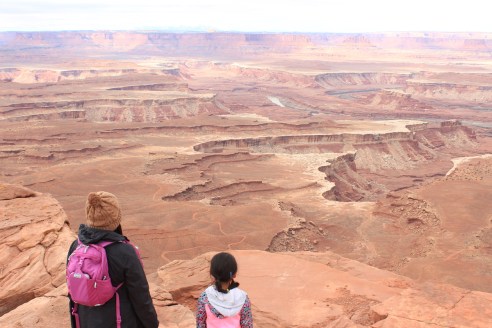
Canyonlands National Park
Location: Kyoto, Japan
Effort Level: Moderate/Difficult
Restrooms at/near trailhead: Yes
Trail Type/Surface: Paved, Stairs loop
Fee: No
Our trail notes: This hike to the shrine was an amazing experience! Bethany loved the challenging stairs (we must have climbed thousands), and walking through the red gates (we must have passed through hundreds).

Fushimi Inari Taisha
Gila Cliff Dwellings National Monument
Location: near Mimbres and Silver City, New Mexico
Effort Level: Easy/Moderate
Restrooms at/near trailhead: Yes
Trail Type/Surface: Dirt out-and-back
Fee: Yes
Our trail notes: The Mogollon resided in these cliff dwellings over 800 years ago, and we had the chance to explore some of the rooms that have survived for centuries. The summer heat and the steady ascent was manageable with water (no snacks allowed on this trail). Our hike here was approximately 1.6 miles total.
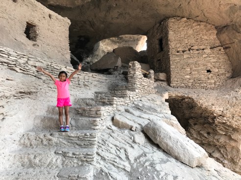
Gila Cliff Dwellings National Monument
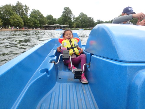
Location: London, UK
Effort Level: Easy
Restrooms at/near trailhead: Yes
Trail Type/Surface: Paved
Fee: Yes
Our trail notes: One of our favorites! From Hyde Park Corner station, we completed a hike around The Serpentine, and then had lunch at the Serpentine Bar & Kitchen.
Location: near Hanksville, Utah
Effort Level: Moderate
Restrooms at/near trailhead: Yes
Trail Type/Surface: Dirt loop/slot canyon
Fee: No
Our trail notes: The hike through narrow passageways composed of waves of sandstone was simply amazing. This was also Bethany’s longest hike to date, at 8.1 miles.
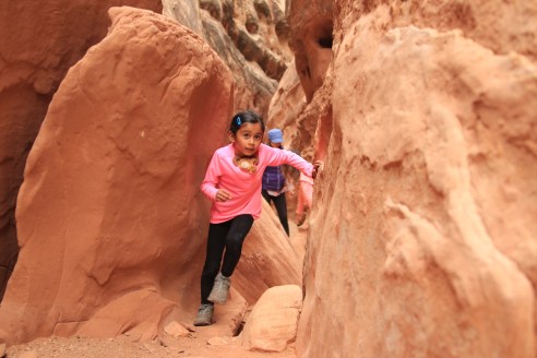
Little Wild Horse Canyon
London Bridge to Tower Bridge
Location: London, UK
Effort Level: Easy
Restrooms at/near trailhead: Yes
Trail Type/Surface: Paved loop
Fee: No
Our trail notes: A walk along the River Thames and crossing two iconic bridges of London is an unforgettable experience.
Location: London, UK
Effort Level: Easy
Restrooms at/near trailhead: No
Trail Type/Surface: Paved out-and-back
Fee: No
Our trail notes: A damp and dimly-lit tunnel that is over 100 years old under the River Thames was an exciting walk for Bethany, especially with our ghost stories and echoing footsteps.

Woolwich Foot Tunnel, London, UK
Zion National Park: The Narrows
Location: Springdale, Utah
Effort Level: Easy/Moderate
Restrooms at/near trailhead: Yes
Trail Type/Surface: Paved leading to the river, then, a river!
Fee: Yes
Our trail notes: One of Bethany’s favorite hikes! Walking upstream against a gentle flow with a view of red canyon walls surrounding us was such a memorable experience! This was interrupted by a sudden hailstorm with accompanying thunder echoing throughout the canyon; thankfully we were prepared with extra clothes stored in dry bags.
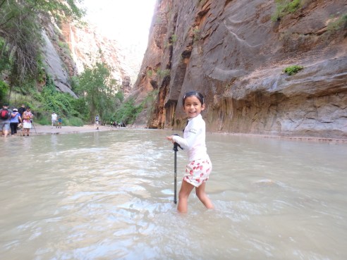
The Narrows, Zion National Park, Utah

Leave a comment